ID 701106 | MPN 705
National Geographic
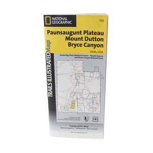
National Geographic Paunsaugunt Plateau Mount Dutton Bryce Canyon Trail Map Utah


Original price:
$14.95
 Sale price:
$4.92(67% Off)

Strikethrough Pricing on Sportsmans.com
Advertised prices may display a strikethrough or regular price. The strikethrough or regular price represents either 1) the manufacturer’s Minimum Advertised Price (MAP) OR the Manufacturer’s Suggested Retail Price (MSRP) or 2) a price at which the product was offered within the last 90 days.National Geographic Paunsaugunt Plateau Mount Dutton Bryce Canyon Trail Map Utah - More than just a map, National Geographic Trails Illustrated topographic maps are designed to take you into the wilderness and back. Printed on tear-resistant, waterproof material, this map can go anywhere you do.
Save up to $50 on your online order today!
Added to Your Cart
Advertised prices may display a strikethrough or regular price. The strikethrough or regular price represents either 1) the manufacturer’s Minimum Advertised Price (MAP) OR the Manufacturer’s Suggested Retail Price (MSRP) or 2) a price at which the product was offered within the last 90 days.
701106

National Geographic Paunsaugunt Plateau Mount Dutton Bryce Canyon Trail Map Utah
by National Geographic
$4.92
Overview
National Geographic Paunsaugunt Plateau Mount Dutton Bryce Canyon Trail Map Utah - This Trails Illustrated topographic map is the most comprehensive and complete recreational map for Utah's Paunsaugunt Plateau/Mount Dutton/Bryce Canyon area. Coverage includes Dixie National Forest. Bryce Canyon National Park; Paunsaugunt Plateau; Red Canyon, Sunset and Pink Cliffs, Johns Valley, Casto Canyon, Swallow Park Ranch, Sevier Plateau and Pole Canyon; Tropic Reservoir, Cottonwood Creek and Sevier Creek.
- Folded Size: 4.25"x9.25"
- Fully Open Size: 25.5"x37.75"
- Scale: 1:50,000
- Map Revised: 1992
Specifications
| Model | 705 |
|---|
Reviews
Notify Me When In Stock
You are tracking this product.
You have removed this product alert
Thank You,
An error occurred processing your request. Please try again later.
Please enter a valid email


CUSTOMER GALLERY