ID 1418600 | MPN MILLER/PINE
Fish N Map
Fish N Map Millerton/Pine Flat/Amador Map


$10.95
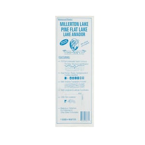
Fish N Map Millerton/Pine Flat/Amador Map - This map shows 10 foot underwater depth contours for easy structure identification. The map also shows boat ramps, roads, campgrounds and facilities.
Save up to $50 on your online order today!
Added to Your Cart
Advertised prices may display a strikethrough or regular price. The strikethrough or regular price represents either 1) the manufacturer’s Minimum Advertised Price (MAP) OR the Manufacturer’s Suggested Retail Price (MSRP) or 2) a price at which the product was offered within the last 90 days.
1418600
Overview
Fish N Map Millerton/Pine Flat/Amador Map -This map shows 10 foot underwater depth contours for easy structure identification. The map also shows boat ramps, roads, campgrounds and facilities.
- 10 foot underwater depth contours
- Boats ramps, roads, campgrounds and facilities
- Onshore topography
- Longitude and latitude coordinates
Specifications
| Model | MILLER/PINE |
|---|
Reviews
Notify Me When In Stock
You are tracking this product.
You have removed this product alert
Thank You,
An error occurred processing your request. Please try again later.
Please enter a valid email


CUSTOMER GALLERY