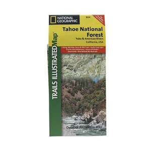
National Geographic Tahoe National Forest Yuba American RiversCalifornia


$14.95

$14.95
Overview
National Geographic Tahoe National Forest Yuba American RiversCalifornia - This Trails Illustrated topographic map is the most comprehensive recreational map for the Yuba and American Rivers area of the Tahoe National Forest. The map shows all trails, campsites, and recreational features. Coverage includes Granite Chief Wilderness, Pacific Crest National Scenic Trial, American (North Fork) Wild and Scenic River, Downieville, Hwy 49 Corridor, New Bullards Bar Res., Saddleback Mtn, Highway 20, Forest Divide, Sugar Pine Res., French Meadows Res., Lake Valley Res., Cascade Lakes, Squaw Valley. Towns: Nevada City, Camptonville, Downieville, Foresthill, Soda Springs. Other highlights: Donner National Scenic Byway, Malakoff Diggins State Historic Park.
- Folded Size: 4.25"x9.25"
- Fully Open Size: 25.5"x37.75"
- Scale: 1:63,360
Specifications
Model | 804 |
Reviews
At Sportsman's Warehouse, we've got you covered.
HERE'S HOW
- If any warranty issue comes up, we'll cover the cost of packing & shipping to the manufacturer from any Sportsman's Warehouse location.
- Cleaning, scope mounting, and bore sighting.
- Discounts on gun customization from The Gunsmith at Sportsman's Warehouse.
- FSP can be applied to any gun purchased at Sportsman's Warehouse or online at Sportsmans.com.
BENEFITS
- Provides two professional field strip & cleanings per year.
- Unlimited professional scope mounting & bore sighting during coverage.
- Provides warranty concurrent with manufacturer's warranty for the firearm, including all parts & labor for warranty repairs during coverage.
- We'll keep you informed of any recall notifications.
- Free packing/shipping to manufacturer &/or manufacturer's authorized service center for warranty repairs ($20-$40 value).
- 15% discount on all customizing & elective gunsmith services and FREE shipping to The Gunsmith at Sportsman's Warehouse.
CUSTOMER GALLERY